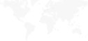
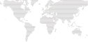
You can limit to one (or several) countries (France, Italy, UK)
## Installation
Requires NodeJS ≥ 18.
```bash
npm i dotted-map
```
## Usage
```js
import fs from 'fs';
import DottedMap from 'dotted-map';
const map = new DottedMap({ height: 60, grid: 'diagonal' });
map.addPin({
lat: 40.73061,
lng: -73.935242,
svgOptions: { color: '#d6ff79', radius: 0.4 },
});
map.addPin({
lat: 48.8534,
lng: 2.3488,
svgOptions: { color: '#fffcf2', radius: 0.4 },
});
const svgMap = map.getSVG({
radius: 0.22,
color: '#423B38',
shape: 'circle',
backgroundColor: '#020300',
});
fs.writeFileSync('./map.svg', svgMap);
```
If you use a large number of points (height or width ≥ 100), it may take a bit of time to compute the map (from 1 to 30 seconds depending on your device and number of points). This is why the result grid is cached. If you don’t change the parameters of `new DottedMap`, the next maps will be a lot faster to generate. You can however change the pins and the SVG options.
It’s also possible to use it in **Leaflet**, see [an example here](https://github.com/NTag/colivings/blob/main/src/App.js).
### Precomputing the map
Because the previous operation can be expansive (especially if you want to use DottedMap in a browser or React Native app), it’s possible to precompute the grid. You will still be able to add pins on-the-fly, in real time. This also allows you to import a lighter version of the library. This is especially useful if you always use the same map parameters, but only change the pins.
```js
// So you do this first step only once, when developing your app
import { getMapJSON } from 'dotted-map';
// This function accepts the same arguments as DottedMap in the example above.
const mapJsonString = getMapJSON({ height: 60, grid: 'diagonal' });
console.log(mapJsonString);
// This string will contain everything about the grid. You will need to copy
// and include it in your front.
```
```js
// Now we are in your app, let’s imagine it’s a React app
// This import doesn’t include coordinates of countries: it’s lighter
// that 'dotted-map', so especially useful in fronts.
// However, you must give it a map you have pre-computed before.
import DottedMap from 'dotted-map/without-countries';
// Basically myMap.js contains something like:
//
// const MyMapString = 'the string mapJsonString that you got on the first step';
// export default MyMapString;
import MyMapString from './myMap';
const MyComponent = () => {
// It’s safe to re-create the map at each render, because of the
// pre-computation it’s super fast ⚡️
const map = new DottedMap({ map: JSON.parse(MyMapString) });
map.addPin({
lat: 40.73061,
lng: -73.935242,
svgOptions: { color: '#d6ff79', radius: 0.4 },
});
const svgMap = map.getSVG({
radius: 0.22,
color: '#423B38',
shape: 'circle',
backgroundColor: '#020300',
});
return (
);
};
export default MyComponent;
```
That’s how you can display a super stylish map in your React webapp, without impacting the size of your bundle nor the performance of your app (browsers are very fast at rendering SVGs).
## Specs
```js
import DottedMap from 'dotted-map';
// Create the map
const map = new DottedMap({
height,
width, // just specify either height or width, so the ratio of the map is correct
countries: [‘FRA’] // look into `countries.geo.json` to see which keys to use. You can also omit this parameter and the whole world will be used
region: { lat: { min, max }, lng: { min, max } }, // if not present, it will fit the countries (and if no country is specified, the whole world)
grid: ‘vertical’ | ‘diagonal’, // how points should be aligned
projection: { name, center }, // optional, see below
avoidOuterPins: false | true, // if it’s true, prevent adding pins when they are outside of region/countries
});
// Add some points/change the color of existing points
map.addPin({
lat,
lng,
svgOptions: { color, radius },
data, // whatever you want, useful if you use the method `getPoints` to get the raw points
});
// If you want to get the raw array of points
map.getPoints();
// [{ x, y, data, svgOptions }]
// Or use this method to get a string which is a SVG
map.getSVG({
shape: 'circle' | 'hexagon', // if you use hexagon, prefer the grid `diagonal`
backgroundColor, // background color of the map
color, // default color of the points
radius: 0.5, // default radius of the points
});
//
```
### Projection
By default, the map uses the Mercator projection. You can optionally pass a `projection` parameter to use a different one:
```js
const map = new DottedMap({
height: 60,
grid: 'diagonal',
projection: { name: 'robinson' },
});
```
Available projections: `mercator` (default), `equirectangular`, `robinson`, `equalEarth`, `mollweide`, `miller`, `sinusoidal`, `orthographic`, `gallPeters`, `vanDerGrinten`.
You can also pass a `center` to shift the map's center point. This is especially useful for `orthographic` (which shows a single hemisphere) but works with any projection:
```js
// Orthographic projection centered on North America
const map = new DottedMap({
height: 60,
grid: 'diagonal',
projection: { name: 'orthographic', center: { lat: 40, lng: -100 } },
});
// Robinson projection centered on the Pacific
const map = new DottedMap({
height: 60,
projection: { name: 'robinson', center: { lat: 0, lng: 150 } },
});
```
Note: for `orthographic`, pins on the back side of the globe (not visible) will be ignored.
## Acknowledgments
Countries are from https://github.com/johan/world.geo.json.
---
_Source: https://npm.io/package/dotted-map · Machine-readable twin of the npm.io package page. Health data is recomputed on every publish._