# us-atlas
> Pre-built TopoJSON from the U.S. Census Bureau.
Latest version **3.0.1** (published 2023-04-19) · ISC license · 0 weekly downloads
## Install
```sh
npm install us-atlas
pnpm add us-atlas
yarn add us-atlas
bun add us-atlas
```
## Health
**Score 15/100 (F)** — status: abandoned.
Positive: no vulnerabilities.
Warnings: low downloads; no types; no esm support.
Negative: abandoned; low maintenance score.
## Facts
| | |
|---|---|
| Version | 3.0.1 |
| Published | 2023-04-19 |
| First published | 2013-02-08 |
| Weekly downloads | 0 |
| License | ISC |
| TypeScript types | none |
| Module format | CommonJS |
| Dependencies | 0 |
| Unpacked size | 1.9 MB |
| Known vulnerabilities | 0 |
| Install scripts | no |
| GitHub stars | 927 |
| Author | Mike Bostock |
| Maintainers | mbostock |
| Keywords | topojson, geojson, shapefile |
## Links
- npm: https://www.npmjs.com/package/us-atlas
- Repository: https://github.com/topojson/us-atlas
- Homepage: https://github.com/topojson/us-atlas#readme
- Issues: https://github.com/topojson/us-atlas/issues
- npm.io page: https://npm.io/package/us-atlas
## Alternatives
- [@mapbox/jsonlint-lines-primitives](https://npm.io/package/@mapbox/jsonlint-lines-primitives.md) — 5.3M weekly downloads
- [reftools](https://npm.io/package/reftools.md) — 3.5M weekly downloads
- [@hey-api/openapi-ts](https://npm.io/package/@hey-api/openapi-ts.md) — 3.5M weekly downloads
- [@mapbox/geojson-rewind](https://npm.io/package/@mapbox/geojson-rewind.md) — 2.4M weekly downloads
- [turbo-stream](https://npm.io/package/turbo-stream.md) — 1.7M weekly downloads
## Recent versions
- 3.0.1 (latest) — 2023-04-19
- 3.0.0 — 2019-08-31
- 2.1.0 — 2019-03-22
- 2.0.0 — 2019-03-22
- 1.0.2 — 2017-03-31
- 1.0.1 — 2017-01-25
- 1.0.0 — 2016-11-03
- 0.1.1 — 2016-11-03
- 0.1.0 — 2016-11-03
- 0.0.4 — 2013-05-19
- 0.0.3 — 2013-05-10
- 0.0.2 — 2013-03-08
- 0.0.1 — 2013-02-08
## README
# U.S. Atlas TopoJSON
This repository provides a convenient redistribution of the [Census Bureau’s](http://www.census.gov/) [cartographic boundary shapefiles](https://www.census.gov/geographies/mapping-files/time-series/geo/carto-boundary-file.html), 2017 edition as TopoJSON. For earlier editions, see [past releases](https://github.com/topojson/us-atlas/releases). Both projected and unprojected geometries are included. The projection used by these files is:
```js
d3.geoAlbersUsa().scale(1300).translate([487.5, 305])
````
This is a conic equal-area Albers projection suitable for choropleth maps and designed to fit a 975×610 viewport.
### Usage
In a browser, using [d3-geo](https://github.com/d3/d3-geo) and SVG:
https://observablehq.com/@d3/u-s-map
In a browser, using [d3-geo](https://github.com/d3/d3-geo) and Canvas:
https://observablehq.com/@d3/u-s-map-canvas
In Node, using [d3-geo](https://github.com/d3/d3-geo) and [node-canvas](https://github.com/Automattic/node-canvas):
https://bl.ocks.org/mbostock/885fffe88d72b2a25c090e0bbbef382f
## File Reference
# counties-10m.json · [Download](https://cdn.jsdelivr.net/npm/us-atlas@3/counties-10m.json "Source")
A [TopoJSON file](https://github.com/topojson/topojson-specification/blob/master/README.md#21-topology-objects) containing the geometry collections counties, states, and nation. The geometry is quantized and simplified, but not projected. This topology is derived from the Census Bureau’s [cartographic county boundaries, 2017 edition](https://www2.census.gov/geo/tiger/GENZ2017/shp/). The state boundaries are computed by [merging](https://github.com/topojson/topojson-client/blob/master/README.md#merge) counties, and the nation boundary is computed by merging states, ensuring a consistent topology.
# counties-albers-10m.json · [Download](https://cdn.jsdelivr.net/npm/us-atlas@3/counties-albers-10m.json "Source")
A [TopoJSON file](https://github.com/topojson/topojson-specification/blob/master/README.md#21-topology-objects) containing the geometry collections counties, states, and nation. The geometry is quantized, projected using [d3.geoAlbersUsa](https://github.com/d3/d3-geo/blob/master/README.md#geoAlbersUsa) to fit a 975×610 viewport, and simplified. This topology is derived from the Census Bureau’s [cartographic county boundaries, 2017 edition](https://www2.census.gov/geo/tiger/GENZ2017/shp/). The state boundaries are computed by [merging](https://github.com/topojson/topojson-client/blob/master/README.md#merge) counties, and the nation boundary is computed by merging states, ensuring a consistent topology.
# states-10m.json · [Download](https://cdn.jsdelivr.net/npm/us-atlas@3/states-10m.json "Source")
A [TopoJSON file](https://github.com/topojson/topojson-specification/blob/master/README.md#21-topology-objects) containing the geometry collections states and nation. The geometry is quantized and simplified, but not projected. This topology is derived from the Census Bureau’s [cartographic state boundaries, 2017 edition](https://www2.census.gov/geo/tiger/GENZ2017/shp/). The nation boundary is computed by [merging](https://github.com/topojson/topojson-client/blob/master/README.md#merge) states, ensuring a consistent topology.
# states-albers-10m.json · [Download](https://cdn.jsdelivr.net/npm/us-atlas@3/states-albers-10m.json "Source")
A [TopoJSON file](https://github.com/topojson/topojson-specification/blob/master/README.md#21-topology-objects) containing the geometry collections states and nation. The geometry is quantized, projected using [d3.geoAlbersUsa](https://github.com/d3/d3-geo/blob/master/README.md#geoAlbersUsa) to fit a 975×610 viewport, and simplified. This topology is derived from the Census Bureau’s [cartographic state boundaries, 2017 edition](https://www2.census.gov/geo/tiger/GENZ2017/shp/). The nation boundary is computed by [merging](https://github.com/topojson/topojson-client/blob/master/README.md#merge) states, ensuring a consistent topology.
# nation-10m.json · [Download](https://cdn.jsdelivr.net/npm/us-atlas@3/nation-10m.json "Source")
A [TopoJSON file](https://github.com/topojson/topojson-specification/blob/master/README.md#21-topology-objects) containing the geometry collection nation. The geometry is quantized and simplified, but not projected. This topology is derived from the Census Bureau’s [cartographic nation boundary, 2017 edition](https://www2.census.gov/geo/tiger/GENZ2017/shp/).
# nation-albers-10m.json · [Download](https://cdn.jsdelivr.net/npm/us-atlas@3/nation-albers-10m.json "Source")
A [TopoJSON file](https://github.com/topojson/topojson-specification/blob/master/README.md#21-topology-objects) containing the geometry collection nation. The geometry is quantized, projected using [d3.geoAlbersUsa](https://github.com/d3/d3-geo/blob/master/README.md#geoAlbersUsa) to fit a 975×610 viewport, and simplified. This topology is derived from the Census Bureau’s [cartographic nation boundary, 2017 edition](https://www2.census.gov/geo/tiger/GENZ2017/shp/).
# *us*.objects.counties
 Each county has two fields:
* *county*.id - the five-digit [FIPS county code](https://en.wikipedia.org/wiki/FIPS_county_code), such as `"06069"`
* *county*.properties.name - the county name, such as `"San Benito"`
The first two digits of the county FIPS code is the state FIPS code.
# *us*.objects.states
Each county has two fields:
* *county*.id - the five-digit [FIPS county code](https://en.wikipedia.org/wiki/FIPS_county_code), such as `"06069"`
* *county*.properties.name - the county name, such as `"San Benito"`
The first two digits of the county FIPS code is the state FIPS code.
# *us*.objects.states
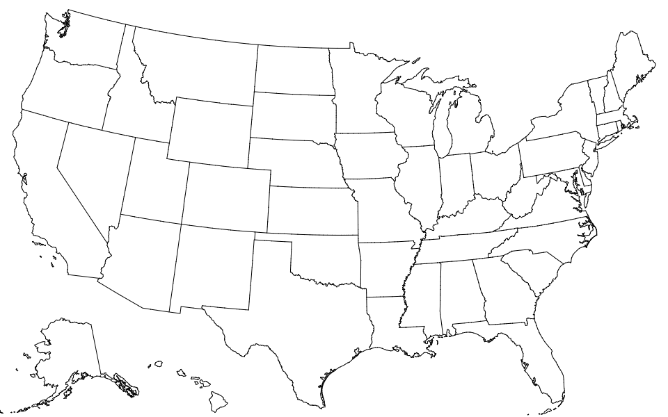 Each state has two fields:
* *state*.id - the two-digit [FIPS state code](https://en.wikipedia.org/wiki/Federal_Information_Processing_Standard_state_code), such as `"06"`
* *state*.properties.name - the state name, such as `"California"`
# *us*.objects.nation
Each state has two fields:
* *state*.id - the two-digit [FIPS state code](https://en.wikipedia.org/wiki/Federal_Information_Processing_Standard_state_code), such as `"06"`
* *state*.properties.name - the state name, such as `"California"`
# *us*.objects.nation
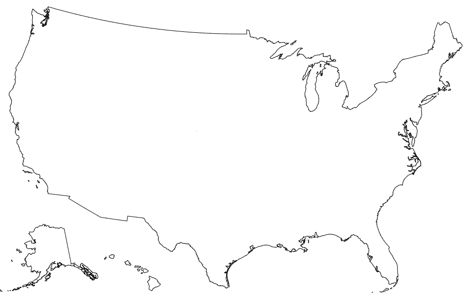 The nation has two fields:
* *nation*.id - the string `"US"`
* *nation*.properties.name - the string `"United States"`
---
_Source: https://npm.io/package/us-atlas · Machine-readable twin of the npm.io package page. Health data is recomputed on every publish._
The nation has two fields:
* *nation*.id - the string `"US"`
* *nation*.properties.name - the string `"United States"`
---
_Source: https://npm.io/package/us-atlas · Machine-readable twin of the npm.io package page. Health data is recomputed on every publish._