aframe-openlayers-component v1.0.2
aframe-openlayers-component
An A-Frame component that allows the use of OpenLayers maps inside A-Frame.
This component allows the use of any OpenLayers map into any A-Frame object. It uses OpenLayers postcompose map event to export the map into an image (using canvas) and then the image is added into the A-Frame material. Also, it tries to pass OpenLayers interactions into A-frame to allow selection, pan, move etc. inside the VR environment.
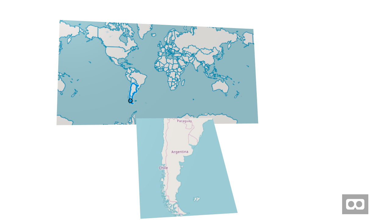
Example with two maps and select interaction:

Schema
| Property | Description | Default Value | Required |
|---|---|---|---|
| map | Javascript variable name of the OpenLayers map to use. | map | true |
| pixToVRRatio | The multiplication factor between meters in A-Frame and the pixels of the map. ie; when set to 100, will display 100 pixels per 1 meter in VR space. Please check Info about map | 100 | true |
| OlEvent | OpenLayers event used in the interaction. This event will be passed into aframe. ie; when select is active probably you pass the click event. More info about OpenLayers interaction events. | click | false |
| aframeEvent | A-Frame event that will be the destiny for the OLEvent. ie; When select interaction is active probably you pass also the click event. More info about A-Frame events. | click | false |
| width | Normally map width is computed based on component width. But in some cases you might not give width in the component, ie; when using a radius instead of width and height. In this cases, if width is not provided in the component, you need to provide a width for the map in VR units (meters). Please check Info about map | false | |
| height | Normally map height is computed based on component height. But in some cases you might not give height in the component, ie; when using a radius instead of width and height. In this cases, if height is not provided in the component, you need to provide a height for the map in VR units (meters). Please check Info about map | false |
Info about map
Map size is computed using the folowing formula: MapWidth = (pixToVRRatio component width) and MapHeight = (pixToVRRatio component height)
The higher pixToVRRatio, the more map area will be displayed per VR unit. The canvas has to be translated into a plane in VR space. This is combined with the width and height in VR space (from geometry.width and geometry.height on the entity or in case they don't exist then from the provided width and height in the OL object) to set up the map plane for rendering in 3D.
The map is rendered as a texture on a 3D plane. For best performance, texture sizes should be kept to powers of 2, because of that, the component automatically resizes geometry.width and/or geometry.height to the closest power of 2 using the provided pixToVRRatio. If you don't want the component to automatically resize your objects you should make sure width * pixToVRRatio and height * pixToVRRatio are powers of 2.
Installation
npm
Via npm:
npm install aframe
npm install aframe-openlayers-component
Then
require('aframe');
require('aframe-openlayers-component');
Directly including the minified file
<html>
  <head>
    <title>A-Frame Openlayers Component - Simple example</title>
    <meta name="description" content="Simple example for OpenLayers component in a flat panel."></meta>
    <!-- Openlayers -->
    <link rel="stylesheet" href="https://openlayers.org/en/v4.6.5/css/ol.css" type="text/css">
    <!-- The line below is only needed for old environments like Internet Explorer and Android 4.x -->
    <script src="https://cdn.polyfill.io/v2/polyfill.min.js?features=requestAnimationFrame,Element.prototype.classList,URL"></script>
    <script src="https://openlayers.org/en/v4.6.5/build/ol-debug.js"></script>
    <!-- A-Frame -->
    <script src="https://aframe.io/releases/0.8.2/aframe.min.js"></script>
    <!-- aframe openlayers component -->
    <script src="https://unpkg.com/aframe-openlayers-component/dist/aframe-openlayers-component.min.js"></script>
    <!-- your OpenLayers map -->
     <script>
        var source1 = new ol.source.OSM();
        var layer1 = new ol.layer.Tile({
          source: source1
        });
        var source2 = new ol.source.Vector({
            url: 'https://openlayers.org/en/v4.6.5/examples/data/geojson/countries.geojson',
            format: new ol.format.GeoJSON()
        });
        var layer2 = new ol.layer.Vector({
            source: source2
        });
        var map = new ol.Map({
            layers: [
                layer1,
                layer2
            ],
            target: 'map',
            controls: ol.control.defaults({
                attributionOptions: {
                    collapsible: false
                }
            }),
            view: new ol.View({
                center: [0, 0],
                zoom: 0.7
            })
        });
	 </script>
  </head>
  <body>
    <a-scene>
      <a-assets>
          <div id="map"></div>
      </a-assets>
      <a-plane
        position="0 2 -2"
        height="2"
        width="4"
        color="#c4c4c4"
        ol="  map: map;
              pixToVRRatio:150;"
     ></a-plane>
    </a-scene>
  </body>
</html>
Examples
All examples are in examples/ folder.
Two map panels. A big one allowing selection and a small with the selected country.
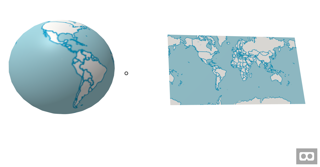
Inverted globe with country selection and a centered mini map.
Notes
Component based on the idea of Allan Walker from https://blog.mapbox.com/mapbox-gl-js-ar-js-a-frame-vr-mapbox-ar-vr-93c09be08742
API had some influences from the A-Frame Tangram-Component
